Get Started with 3D GIS

Explore ArcGIS 3D products

Find the right solution
3D building mockup with routes highlighted in red, blue, and green with an overlayed translucent white square logo

Why ArcGIS?

With expertise in supporting infrastructure; natural resources; architecture, engineering, and construction (AEC); government; and security operations, Esri offers a range of tools and applications that enable streamlined 3D and digital twin workflows.

Leverage your technology

Optimize work efficiency and quality with a well-architected framework that maximizes Esri technology capabilities.

Empower your people

Maximize the potential of ArcGIS with comprehensive training and ongoing support, empowering your workforce with essential skills.

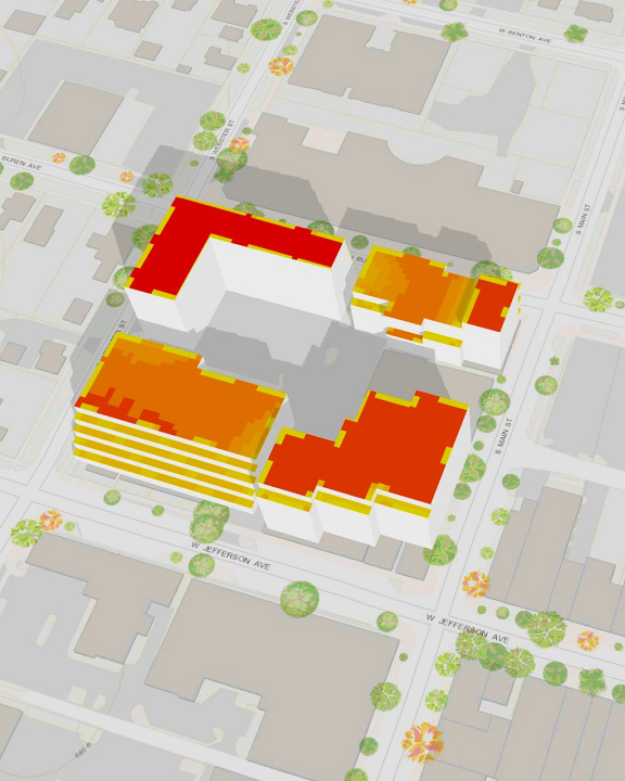
Deliver the power of 3D maps to your organization

Leverage 3D map capabilities strategically to maximize location intelligence benefits across your organization, fostering interoperability.

Aerial view of a vibrant downtown cityscape with clustered buildings and illuminated high-rise buildings
3D aerial view of a gray city plot with buildings colored in a gradient from yellow to red, green trees, and gray roads

Visualize dynamic workspaces in ArcGIS

Visualize sustainable city designs in 3D that prioritize green spaces and eco-friendly infrastructure with ArcGIS.

Start your 3D journey with these products

No matter your experience level, we've got the perfect path for you. Our solutions cater to all expertise levels, ensuring a seamless transition into the 3D mapping world of ArcGIS. Maximize the full potential of spatial analysis, mapping, and 3D data visualization.

Previous
Next

Enhance your 3D experience in ArcGIS

Extend the capabilities of ArcGIS Online, ArcGIS Pro, and ArcGIS Enterprise with complementary extensions and 3D applications.

3D content and data management

Elevate your organization's capabilities with ArcGIS—a powerful enterprise IT system that helps teams create, store, and manage 3D content.

Previous
Next

3D analysis

Explore the comprehensive 3D analysis capabilities offered by ArcGIS for a deeper understanding of your geospatial data.

Previous
Next

3D visualization

The powerful visualization tools available in ArcGIS allow users to represent and explore spatial data in three dimensions.

Previous
Next

Immersive experiences

ArcGIS supports 3D and XR experiences that let users explore and analyze spatial relationships in an intuitive way across a variety of devices, dashboards, and applications.

Previous
Next

Need more information?

Email us

Questions about buying ArcGIS, pricing or need support? Email us at solutions@esribelux.com

solutions@esribelux.com

Contact customer support

Visit our support page

Visit

Call us

Speak with a representative

32 (0)2 460 74 80