Better understanding
Geospatially enabled statistics help us better understand trends, provide perspective and predictive insights, and further enhance our ability to make smart decisions for our communities and our nations.

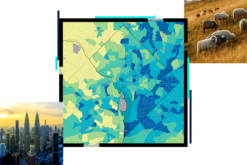
Enabling statistics for a smarter nation
ArcGIS can help strengthen statistical systems by integrating location, improving accuracy, and increasing efficiencies and effectiveness. Official statistics agencies can use ArcGIS to:

Esri's ArcGIS technology integrates many new innovations in data science, measurement, and computing. ArcGIS allows for the integration of new data sources from drones, satellites, and other sensors and the use of geospatial artificial intelligence (GeoAI).

This program provides resource-constrained countries with the GIS tools and training needed to conduct a successful census.
GIS and the 2020 Census: Modernizing Official Statistics provides statistical organizations with the most recent GIS methodologies and technological tools to support census workers' needs at all the stages of a census.
A new set of discounted software bundles is now available for purchase by National Statistical Offices (NSOs) in eligible countries.
Hands-on tutorials help official statistics agencies modernize their workflows, covering every stage of the census process.
Las organizaciones de estadísticas nacionales deben mantenerse al día de las últimas tendencias nacionales de modernización, tecnología e información. Asista a uno de nuestros seminarios web informativos o hable con uno de nuestros expertos del sector de las estadísticas en un evento.

Find out how your peers are using Esri technology to achieve their goals.

Las estadísticas afectan a muchas facetas de nuestra vida. Desde la política y la toma de decisiones hasta los distritos electorales, la seguridad pública y la sostenibilidad, las estadísticas oficiales y los SIG están haciendo que nuestras comunidades sean más inteligentes.